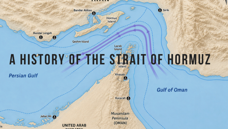
The Strait of Hormuz is approximately 167 kilometres long and 39 kilometres wide at its narrowest navigable point. It is bordered by Iran to the north and the Musandam Peninsula of Oman to the south, with a small section under UAE sovereignty.
Few stretches of water have done more to shape the course of human civilization than this narrow passage between the Persian Gulf and the open ocean. For more than four thousand years, empires have risen and fallen in competition for it, and today it remains the single most consequential maritime chokepoint on Earth.
Before Oil: A Passage Between Worlds
The story of the Strait of Hormuz begins not with petroleum but with pepper, silk, and frankincense. For over four thousand years, it served as a maritime crossroads, first for ancient traders navigating between Mesopotamia and the Indus Valley, and later for empires, navies, and multinational corporations. The strait was, in essence, the hinge between civilisations: to pass through it was to move between the world of the Arabian Peninsula and the riches of Persia, India, and East Africa.
Since the ancient Mesopotamian era, it has been a vital maritime hub for trade toward the Horn of Africa and across into the Indian Ocean. Merchants carrying dates, copper, and lapis lazuli from the Gulf moved through these waters toward the ports of the Indus Valley civilization. In the other direction came timber, cotton, and the luxury goods that sustained the aristocracies of the ancient Near East.
The very name of the strait tells its own history. The word Hormuz is derived from the holiest name of the god of the Zoroastrian faith, a reminder that the waterway’s identity is inseparable from the Persian civilisations that first grasped its strategic potential.
Cyrus the Great and his successors understood the importance of sea power and coastal administration in controlling both trade and military movement. Under Darius I (522–486 BCE), naval exploration extended into the Indian Ocean, and Persian fleets operated throughout the Gulf region. The Achaemenid Empire managed to secure the strait’s approaches by forming alliances or asserting dominance over coastal peoples, ensuring a steady flow of tribute and trade goods.
The Greeks, too, recognised what they had found here. The Periplus of the Erythraean Sea, a first-century merchant’s sailing guide, documented the routes through the Gulf with commercial precision, recording winds, anchorages, and the goods available at each port. Alexander the Great charted the strait as a navigable passage, though it would take a later empire to understand its full coercive potential.
The Sassanids and the Birth of Economic Warfare
Iranian leaders first discovered the power of the Strait of Hormuz around 224 AD, almost 500 years after Alexander the Great first charted it as a navigable shipping passage, when the Persian Sassanid Empire began its centuries of Middle Eastern dominance. A new phenomenon known as global trade had recently emerged, and the flow of luxury goods from the Indian subcontinent was enriching the much more powerful Roman Empire, making its capitals in Rome and then Constantinople dependent on flows of silk, spices and other high-end commodities. All seaborne trade in such Asian goods had to pass through that narrow strait.
The implications were enormous. Rome’s appetite for Eastern luxuries – the silks, the spices, the perfumes that lubricated the machinery of imperial patronage – could be taxed, throttled, or denied entirely by whoever sat astride the passage. The Sassanids were not slow to understand this. They became the first to deploy the strait not merely as a trade corridor but as a lever of geopolitical pressure: a tool that has, ever since, remained fundamentally unchanged.
The Iranian tactic of using the Strait of Hormuz to hold the world economy hostage has remained virtually unchanged over more than 1,800 years.
The Kingdom of Hormuz: Wealth Built on Taxing the World
After the collapse of Sassanid power before the Islamic conquest in the seventh century, the strait passed through successive hands; Umayyad, Abbasid, and eventually into the orbit of local Arab Muslim dynasties who grasped its revenue-generating potential with characteristic brilliance.
After four centuries of Persian dominance, the Zoroastrian Persians were defeated by Muslim Arabs from across the Strait, who soon turned Hormuz into its own, spectacular kingdom, centred around the location of present-day Oman. The strategy of the Kingdom of Hormuz was not to intercept trade but to tax it heavily, and to distribute the revenues in its cities; this turned the kingdom into a lavishly wealthy land of many cultures and religions.
Medieval travellers described Hormuz with astonishment. Marco Polo, passing through in the thirteenth century, called it “the gem in the ring of the world”. The island city – perpetually hot, almost treeless, home to merchants from across the known world – was simultaneously a marvel and a marvel of extraction. Every ship that passed through paid its dues. The kingdom that controlled the gate became, in consequence, extraordinarily rich.
By the medieval period, the strait’s importance was registering in Islamic cartography. Al-Idrisi’s Tabula Rogeriana (1154), a blend of Greek, Islamic, and firsthand traveller knowledge, mapped the Persian Gulf and the Indian Ocean with growing precision, tending to emphasise trade routes, coastal towns, and the wider maritime environment.
The Portuguese: Europe Arrives at the Gate
The arrival of European maritime power changed everything. In 1507, Portuguese explorer Afonso de Albuquerque sailed into the Gulf on the heels of Vasco da Gama’s opening of the Cape route to India; a route that had, at a stroke, changed the economics of Eastern trade by circumventing the overland paths that had enriched the Levant and the Ottoman world for centuries.
After capturing the small island of Hormuz, the Portuguese built a fortress and a customs house there to collect tolls from ships passing through the strait to trade in commodities like silk, spices, pearls and Arabian horses. Portuguese authorities issued “cartazas” – paid permission to trade in the Persian Gulf.
The logic was unchanged from that of the Kingdom of Hormuz before them: control the passage, tax the world. Having secured a headquarters at Goa in 1510, Albuquerque moved to secure the strategic emporia cities of trade across the Indian Ocean in an attempt to control trade and effect a monopoly. The fortress of Hormuz was one of these key points, as it stood on the strait that led into the Persian Gulf.
The Ottoman Empire, newly ascendant and hungry for its share of Eastern commerce, was not prepared to accept Portuguese dominance quietly. The Ottomans sought to displace the Portuguese from the entrance to the Persian Gulf. Three engagements by the Ottomans failed, however, and the Arabian Sea remained in Portuguese control until the coming of the Dutch in the seventeenth century. The most notable of these Ottoman attempts came in 1552 under the admiral and cartographer Piri Reis, who briefly gained ground before retreating, and was subsequently beheaded for his failure.
A Portuguese map from 1519 in the Lopo Homen-Reinal Atlas clearly marks the island of Hormuz and nearby coastal features, decorated with fortresses and figures, reflecting the growing European interest in controlling the maritime routes of the East.
The Safavids, the East India Company, and the Expulsion of Portugal
Portugal held Hormuz for over a century; a remarkable run, but ultimately untenable against the combined hostility of the regional power and a rising European competitor with commercial instincts at least as sharp as its military ones.
The Portuguese enriched themselves on trade through the Strait of Hormuz for a century until they were driven out in 1622 by an alliance between Abbas I, Shah of Persia’s powerful Safavid dynasty, and the English East India Company. The English provided naval power in return for lucrative trading contracts with the Safavids.
This alliance – pragmatic, mutually beneficial, and entirely indifferent to ideology – established a template that would recur throughout the strait’s modern history: an external naval power aligning with a regional state against a common rival, with commercial advantage as the animating logic.
The expulsion of Portugal did not diminish the strait’s importance. It simply shifted the beneficiary. European, Ottoman, Persian, and later British interests converged in the region, and maps from the eighteenth and nineteenth centuries increasingly depicted it with greater precision, reflecting advances in surveying and navigation.
Oil, Empire, and the Making of the Modern Strait
Everything that preceded the twentieth century was, in a sense, a prologue. The discovery of oil transformed the strategic calculus of the Strait of Hormuz from important to existential.
After oil was discovered in Iran in 1908, the British played a leading role in exploiting the resource. The company that later became BP started out as the Anglo-Persian Oil Company, which won a lopsided deal in 1933 to control Iran’s oil exports.
The strategic importance of the Strait of Hormuz increased dramatically in the twentieth century with the discovery and large-scale exploitation of petroleum resources in the Persian Gulf region. Major oil reserves discovered in Saudi Arabia, Kuwait, Iraq, Qatar, and the United Arab Emirates transformed the Gulf into the world’s primary energy production hub. As global demand for oil expanded after World War II, tanker shipping through the Strait of Hormuz increased exponentially.
The strait’s role as the chokepoint for this traffic made it, by the second half of the twentieth century, arguably the single most strategically consequential piece of geography on the planet. The navigable shipping lanes – approximately three kilometres wide in each direction, separated by a two-kilometre buffer zone – were the eye of a needle through which the industrialised world’s energy supply had to pass.
The first major crisis of the oil era unfolded not over production but over ownership. In 1951, Iranian Prime Minister Mohammad Mossadegh announced that Iran was nationalising its oil industry, which included the largest oil refinery in the world at the time at Abadan. The British responded by sending the Royal Navy to establish a blockade around the port of Abadan and prevent any Iranian oil tankers from passing through the Strait of Hormuz. Britain, in other words, weaponised the strait against Iran, the same tactic Iranian leaders had used against Rome eighteen centuries earlier, now reversed.
The British and Americans responded in 1953 with a CIA-backed coup that overthrew Mossadegh and reinstalled the Shah. The result was an agreement that split oil profits evenly between Iran and Western oil companies. The episode left deep wounds in Iranian political culture, wounds that would shape the region’s trajectory for the remainder of the century.
The Tanker War: The Strait as a Battlefield
The Iranian Revolution of 1979 remade the political geography of the Gulf. The Shah’s departure and the establishment of the Islamic Republic fundamentally altered Iran’s relationship with the West and with its neighbours. When Iraq invaded Iran in 1980, the resulting eight-year war did not merely devastate two nations, it turned the Strait of Hormuz into the most dangerous stretch of water in the world.
The Tanker War was a series of military attacks by Iran and Iraq against merchant vessels in the Persian Gulf and Strait of Hormuz from 1981 to 1988. Iraq was responsible for 283 attacks; Iran accounted for 168.
The targeting by Iran and Iraq of each other’s merchant shipping and in particular oil tankers represented the most sustained attack on merchant shipping since the Second World War, and resulted in over 400 civilian seamen killed, hundreds of merchant ships damaged and substantial economic losses. Its broader significance lay in the danger such attacks posed to an international economy critically dependent on Gulf oil exports traversing the Straits of Hormuz chokepoint.
Iraq’s aim in attacking Iranian shipping was to provoke the Iranians to retaliate with extreme measures, such as closing the Strait of Hormuz to all maritime traffic, thereby bringing about foreign intervention against Iran. Iran, for its part, threatened closure repeatedly but held back, aware that its own oil-dependent economy would be among the casualties.
The crisis drew in the United States directly. During the Tanker War, the US sent warships to escort neutral tankers safely through the Strait of Hormuz. In 1988, an Iranian mine damaged the USS Samuel B. Roberts, a naval frigate on escort duty in the Persian Gulf. The US responded with Operation Praying Mantis, a major military operation that sank or crippled much of the Iranian navy. Later that year, a US warship accidentally shot down Iran Air Flight 655, killing all 290 civilians aboard.
The episode demonstrated both the strait’s vulnerability and a paradox that has shaped policy ever since: that full closure is, for Iran, a form of economic self-destruction. Its own exports, its own imports, its own economic survival depend on the passage remaining open. The threat of closure, rather than closure itself, has historically been the instrument.
The Contemporary Chokepoint: Geography as Leverage
The numbers alone explain the world’s anxious attention to this narrow water. During 2023–2025, 20% of the world’s liquefied natural gas and 25% of seaborne oil trade passed through the strait annually. It is the only maritime route for several Gulf countries including UAE, Qatar, Bahrain, Kuwait, and Iraq.
Approximately 20–21 million barrels of crude oil per day, representing nearly 20 percent of global petroleum consumption, pass through this narrow waterway. In addition, about 20 percent of global liquefied natural gas trade also transits the strait. The Persian Gulf is also, notably, a major hub for global fertiliser production, meaning the strait’s disruption would ripple through food systems as well as energy markets.
The shallow surrounding waters create their own strategic dynamics. The surrounding waters are shallow, creating challenges for navigation and making maritime forces more vulnerable to threats from land-based missile systems. Iran, with its coastline running the full length of the strait’s northern shore, has invested heavily in precisely those capabilities: its naval forces, including the Islamic Revolutionary Guard Corps, have developed asymmetric warfare tactics such as deploying fast boats, mines, and drones to monitor and restrict maritime traffic.
The legal dimension is equally contested. Iran interprets UNCLOS provisions differently from most signatories. While Iran is a signatory to the convention, it insists that only countries that have ratified the treaty are entitled to benefit from transit passage. Moreover, Iran has occasionally challenged US naval operations in the strait, arguing that they violate Iranian sovereignty, a claim the United States, which asserts freedom of navigation based on customary international law, contests.
The Question That Has Not Changed
Since 2021, Iran has harassed, attacked or seized nearly 20 internationally flagged merchant vessels, presenting a clear threat to regional maritime security. Each episode, whether the seizure of a Danish container ship in 2015, a British-flagged tanker in 2019, or subsequent incidents, has followed a recognisable logic: demonstration of leverage without the self-destructive step of full closure.
Alternative routes exist, but none are adequate substitutes. Saudi Arabia has invested in overland pipeline infrastructure to reduce its own dependence on the strait. Oman, whose coastline opens directly to the Indian Ocean, has positioned itself as a logistics hub that partially bypasses the chokepoint. But the volumes involved are simply too great: a temporary or prolonged closure of this maritime corridor would have severe economic consequences for the global energy market, with higher energy costs affecting nearly all sectors of the global economy including shipping, aviation, food production, and manufacturing.
The Strait’s enduring potency is a reminder of how little has really changed in the architecture and substance of global commerce; how much of our futuristic life of invisible, clean-looking technology remains rooted in a deeper movement of ancient, crude combustible resources passing through millennia-old sea channels between fortified cliffs.
The empires change. The ships change. The cargoes change. But the strait itself – 21 miles of contested, churning, indispensable water – remains what it has always been: the throat of the world, and the place where those who hold it and those who need it will always, eventually, meet.